
Unst - Part 1
Britain's North Frontier
SHETLANDSCOTLANDTRAVEL
1/18/20254 min read
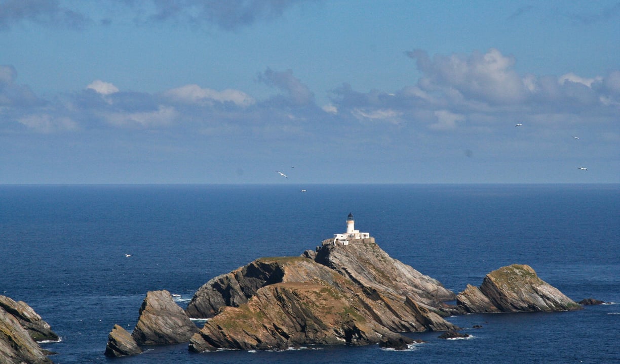
Picture: Muckle Flugga, Britain's most Northern lighthouse
Unst is the Northern tip of Shetland and the most Northerly inhabited island in the British Isles.... and it's a fabulous place to visit especially if, like me, you want to get 'far from the madding crowd'.
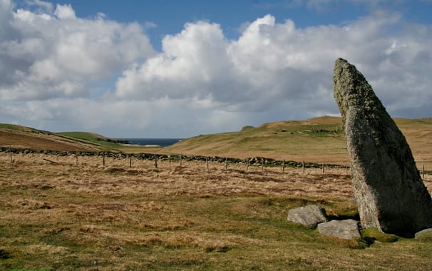
It sits at 60Deg North (that's the same latitude as Cape Farewell in Greenland) on the dividing line between the North Sea and the Atlantic. Despite it's remote location it is known that the island has been inhabited for at least 4000 years as confirmed by the Lund Standing Stone (there is some evidence to suggest that this dates back to around 3500BC).
Unst was inhabited by the Picts and then the Vikings, eventually becoming part of the Kingdom of Norway (along with the rest of Shetland), it has been part of Scotland since 1472 and is now looking to the future with the building of Britain's first 'Spaceport' the first launches are expected to take place in 2025
Picture: Lund Standing Stone
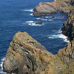
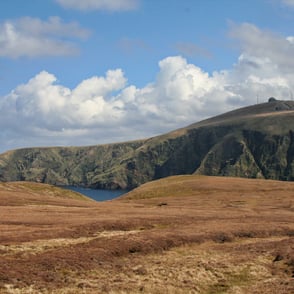
Hermaness
Hermaness is on the North West side of Unst and is the most Northern part of the island. It is a National Nature Reserve, a site of Special Scientific Interest and part of the Shetland Geopark.
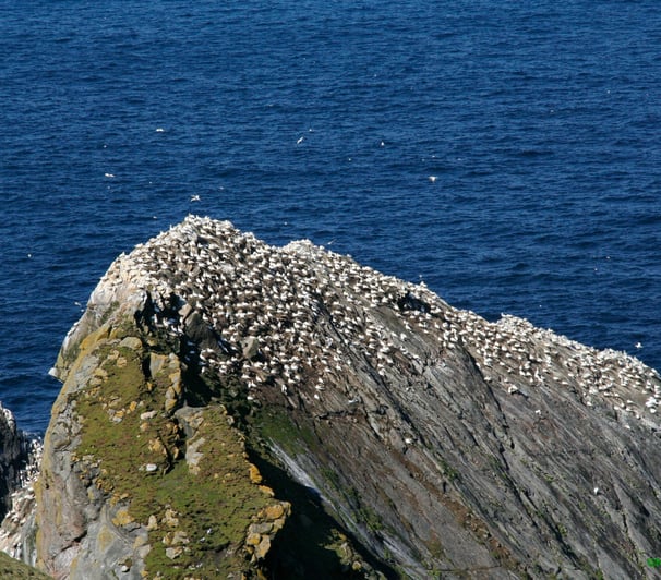
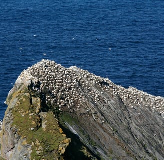
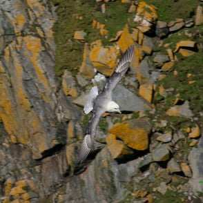
It is an internationally important nesting site for seabirds, if you go in the spring you are likely to see (amongst others) gannets, guillemots, fulmars, gulls, shags, kittiwakes and puffins around the cliffs. In the marshy inland areas you may see dunlin, golden plover, snipe and other waders.
Hermaness is also home to the third largest colony in the world of the Great Skua (known locally as bonxies). These large, majestic birds can be aggressive if they feel threatened but as long as you stick to the paths they seem to be happy to let you pass.
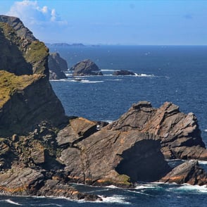
Much work has been done since we last visited to improve access so if you have three or four hours to spare (you may want to spend more time) and are reasonably fit then I would highly recommend that you take the well marked route to see the cliffs and birds especially as this will lead you to the magnificent Muckle Flugga and it's lighthouse....
Picture: Seabird breeding colony.
Muckle Flugga Lighthouse
This is the most Northly light house in the British Isles and quite likely the most exposed. To the West the nearest dry land is the Southern tip of Greenland to the North the next solid ground is in the Far East of Siberia.
The first (temporary) Lighthouse was designed and built by Thomas and David Stevenson (they didn't want to build it there but were overruled) at the behest of the British Government in 1854, as a measure to protect shipping during the Crimean War. During the first winter waves swept over the top of the rock 61m (200ft) above sea level, shortly after waves smashed through the solid iron door and flooded the crew accommodation. In 1858 the lighthouse we see today was built with a solid retaining wall around the site, it was originally called North Unst but was changed to Muckle Flugga in 1964.
On New Years Day 1992 a massive storm drove in, unofficial readings at Muckle Flugga recorded gusts of 172mph just before the measuring equipment blew away, at the nearby RAF base of Saxa Vord (285m above sea level) readings reached 200mph before the equipment was destroyed. A few miles to the South West trawlers moored at Sullom Voe recorded sustained winds of 150mph.
Two holiday makers took shelter from the storm in the bird watchers hut that was located just below the crest of Hermaness Hill. The storm destroyed the hut and the poor people were killed.
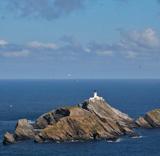
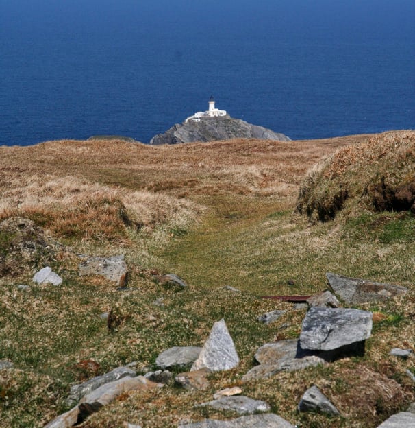
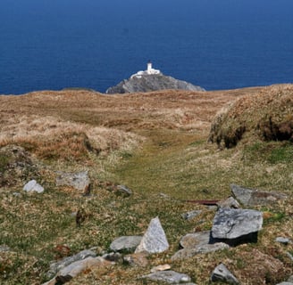
Picture: Muckle Flugga taken from the signalling station at the top of Hermaness Hill
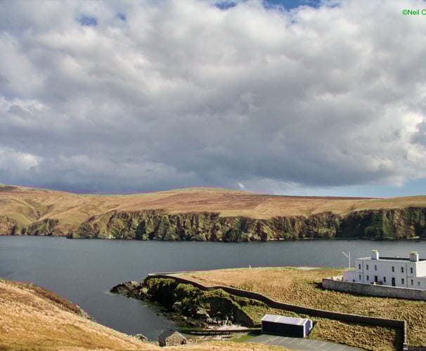
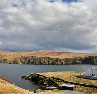
The lighthouse keepers worked one month on and one month off and lived, while ashore, with their families at the Burrafirth Shoreside Station.
In the early days getting the men (they were all men) and supplies on and off the rock was dangerous and back breaking work. An open boat was used to get the supplies to the island then they had to be hauled up the steep cliff. Various methods involving hoists of one kind or another were employed, they even built a rail system. In more recent times a helicopter was employed for deliveries once every two weeks.
In 1995 the lighthouse was automated and the lighthouse keeper jobs were gone.
Picture: Burrafirth Shore Station - if you click on the image you will see the radar dome at Saxa Vord (to the left).
For more information about the lighthouse visit https://www.northlinkferries.co.uk/shetland-blog/muckle-flugga-lighthouse/
For more information about Hermaness visit https://www.nature.scot/sites/default/files/2018-02/The%20Story%20of%20Hermaness%20National%20Nature%20Reserve.pdf
Gallery: A selection of shots taken around Hermaness (click on an image to enlarge it)
In the next part I will be taking a look at some of the other places of interest on Unst and taking a look at the geology of the island.